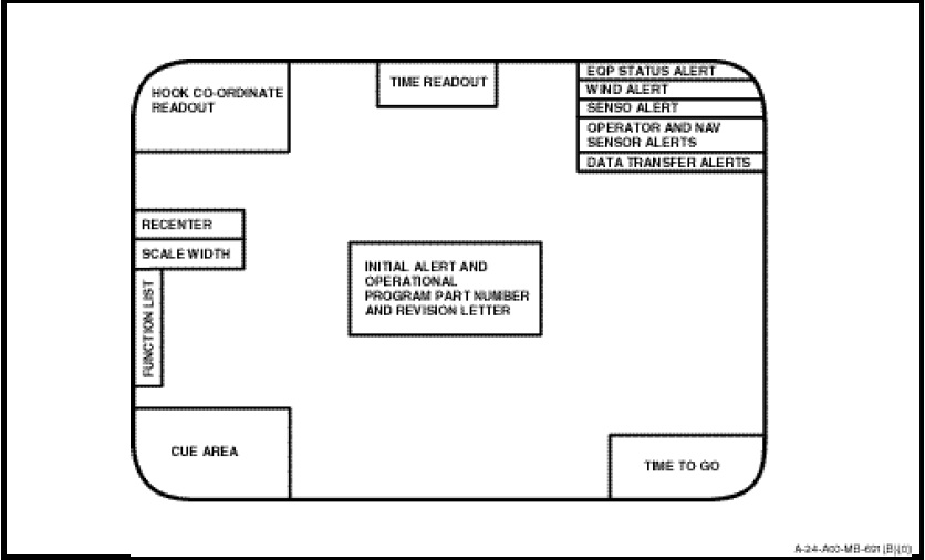
Auxiliary data related to the tactical plot is displayed on the CRT. The following is the data displayed. See Figure 1-14-10 for locations.
a. Display SCALE WIDTH. The selected display scale and corresponding width appear at left centre of the CRT. The upper figure representing the number of NM per inch and the lower figure is the number of nautical miles represented by the full width of the CRT.
b. HOOK CO-ORDINATE. Whenever the COORD function is used, the hook coordinates and/or related data appear in this area.
c. TIME READOUT. This area displayed the running real time in hours, minutes and seconds.
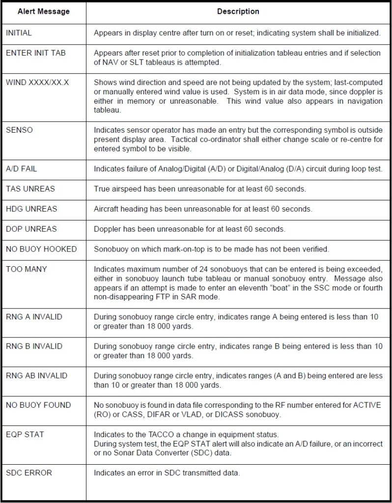
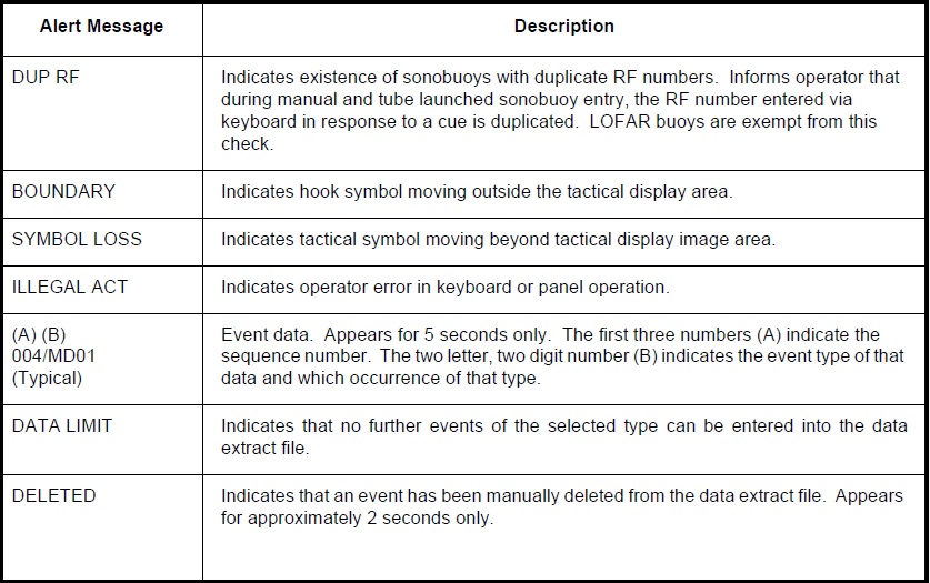
d. ALERT Area. This area displays alert messages (see Figure 1-14-11) that may be presented by the system. The exception is the INITIAL alert, which appears in the centre of the display after a reset operation.
e. TIME TO GO. When a fly-to point, intercept point or dip point is entered, the time to go from present position to that point is displayed and continually updated.
f. CUE AREA. This area provides cues to the operator facilitating various entry procedures.